Lander Road
The Lander Road, also known as the Lander Trail or Lander Cutoff, was developed as the first US government sponsored road to benefit emigrants heading to California. The government was seeking a means to keep western emigrants away from the Mormons in Utah after the Mountain Meadows Massacre of 1856. Visionaries were also looking for a northern railroad route to the Pacific.
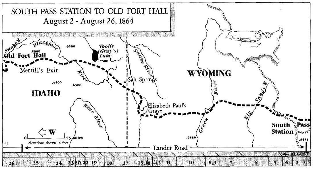
Frederick W. Lander, an engineer from the Department of Interior, supervised construction of an alternate road for the Oregon Trail from South Pass to rejoin the regular Oregon Trail at Ross Fork, above Fort Hall. Congress funded the project in February 1857, with construction taking place in 1858 and 1859. The route was part of the Fort Kearny, South Pass, and Honey Lake Wagon Road.
In 1857, Lander traveled 3,000 miles scouting sixteen passes for the best route across the mountains. He selected a northern route to obtain better grazing, water, fuel, fish, and game for emigrant travelers.
Construction of the basic route was completed by November 1858. Lander reported that 62,310 cubic yards of earth were excavated, one mile of rock removed, eleven miles of willows cleared, and twenty-three miles of pine timber removed from the roadway in making a level road of 256 miles from South Pass to Fort Hall.
Lander wrote a guide for his new route during the winter of 1858-59, then resumed construction in the spring. He spent most of 1859 improving the road from South Pass to City of Rocks and negotiating with Indians along the route for the peaceful passage of emigrants. He returned to the road in 1860, working on the section in the Honey Lake area of northeast California.
Lander joined the Civil War effort as a General and led a cavalry charge at the Battle of Bloomery Gap on February 14, 1862, in what is now West Virginia. Unfortunately, Lander died of pneumonia on March 2, 1862.
His route branched from the Oregon Trail at Burnt Ranch/Gilbert Station near South Pass, then west across Wyoming. The Lander Road enters Idaho near Afton, Wyoming, travels northwest and west, before rejoining the original Oregon Trail at Ross Fork, a few miles from Fort Hall. The Lander Road then followed the Raft River route of the California Trail before turning northwest to follow the Applegate Trail into southern Oregon.
Emigrants began using the route while Lander was still building the road. As the gold rush developed in Montana and Idaho in the 1860s, Lander’s road became a major route for miners heading to the gold fields. In the 1870’s and beyond, large herds of cattle, horses, and sheep traveled over the Lander Road in both directions.
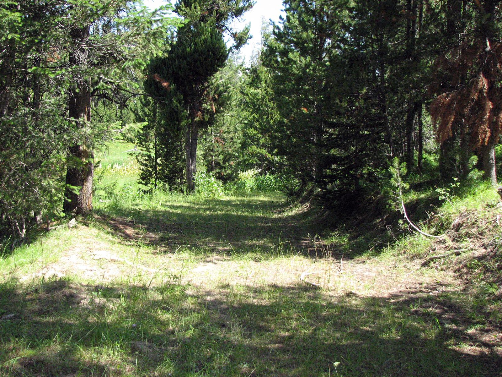
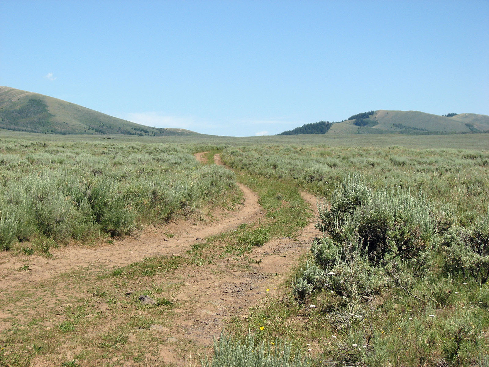
Excellent remnants of the Lander Road exist along much of the route:
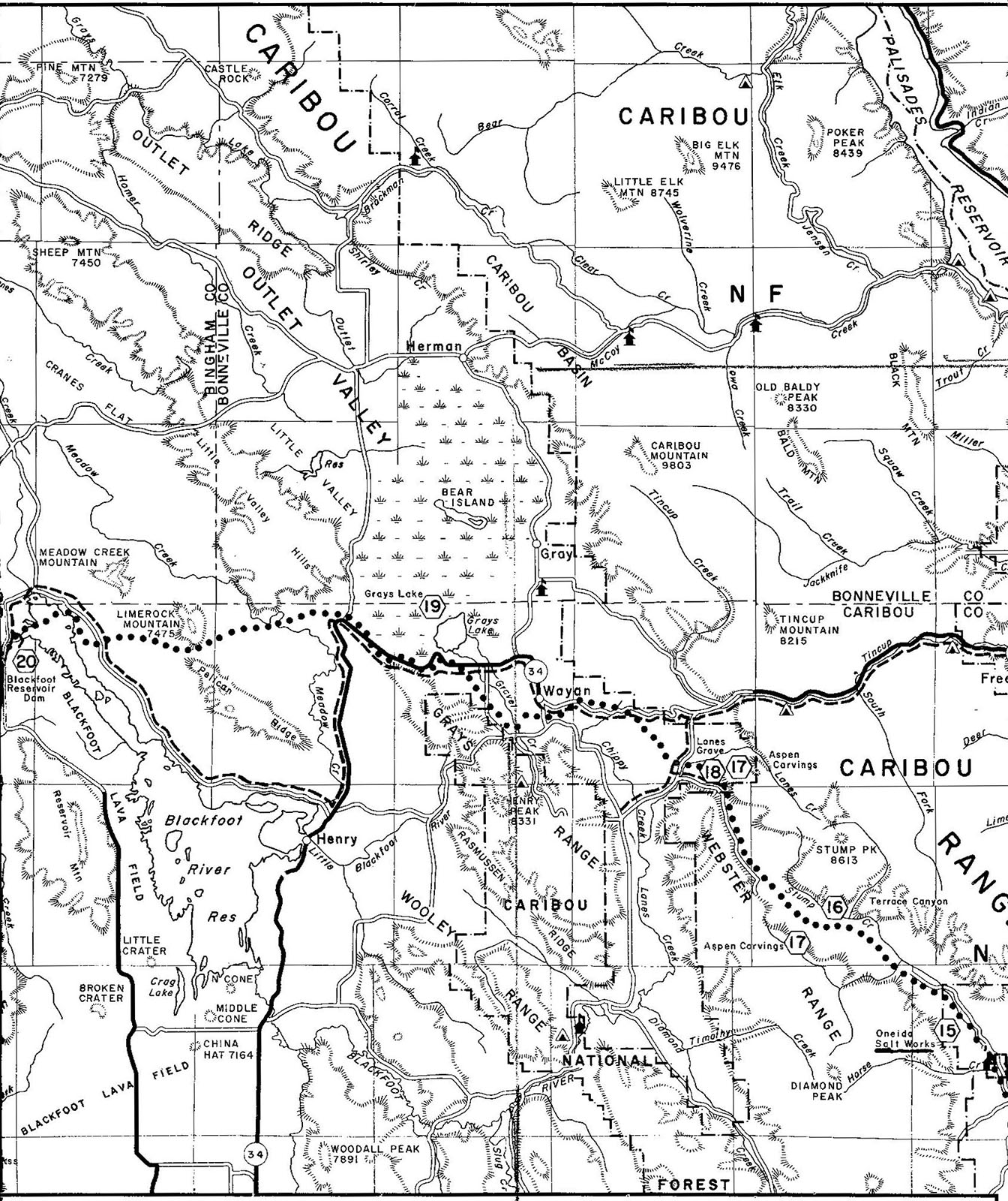
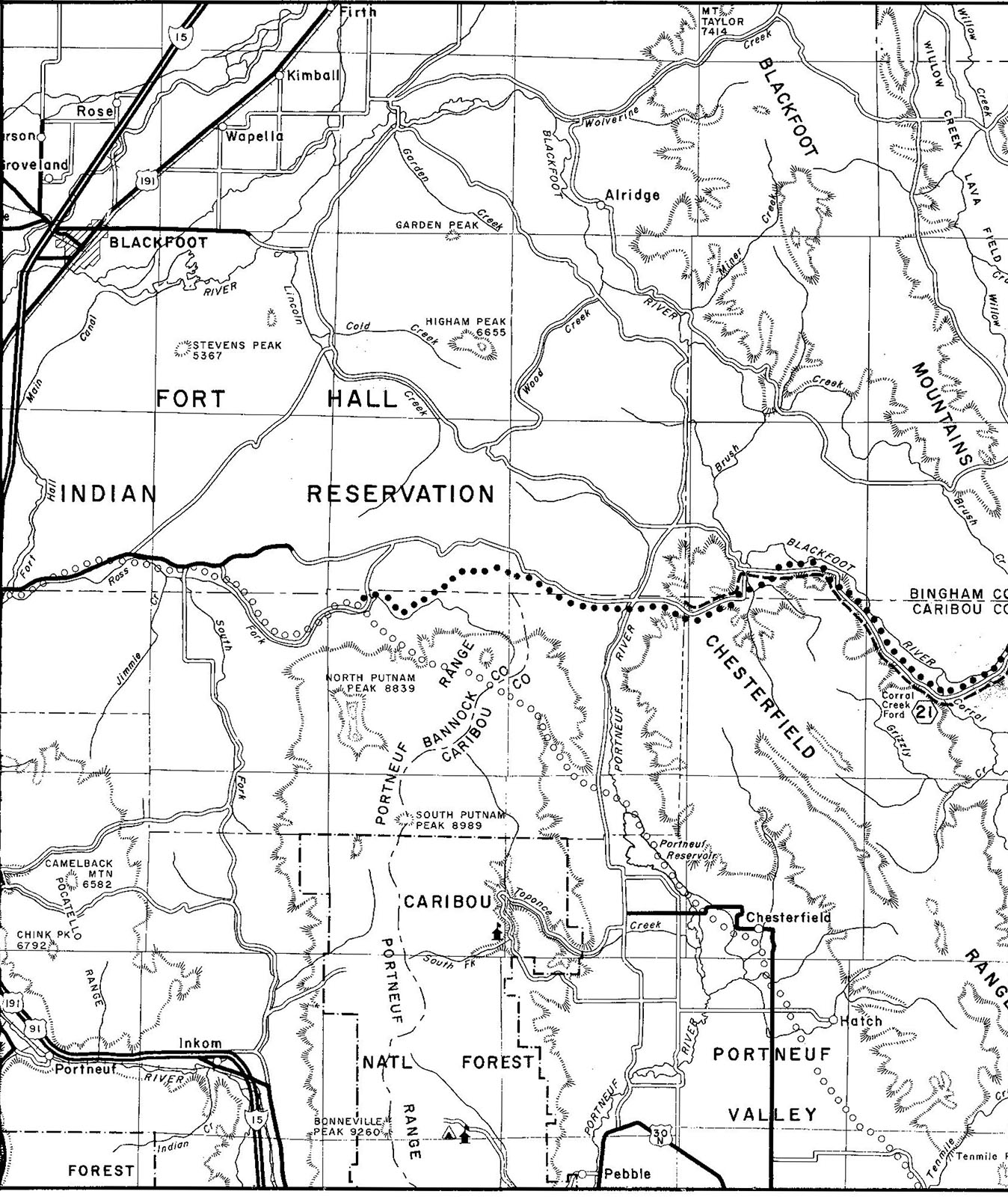
- Lander Road from Wyoming border to Blackfoot River
- Lander Road from Wyoming border to Blackfoot River
- Lander Road from Blackfoot River to Ross Fork
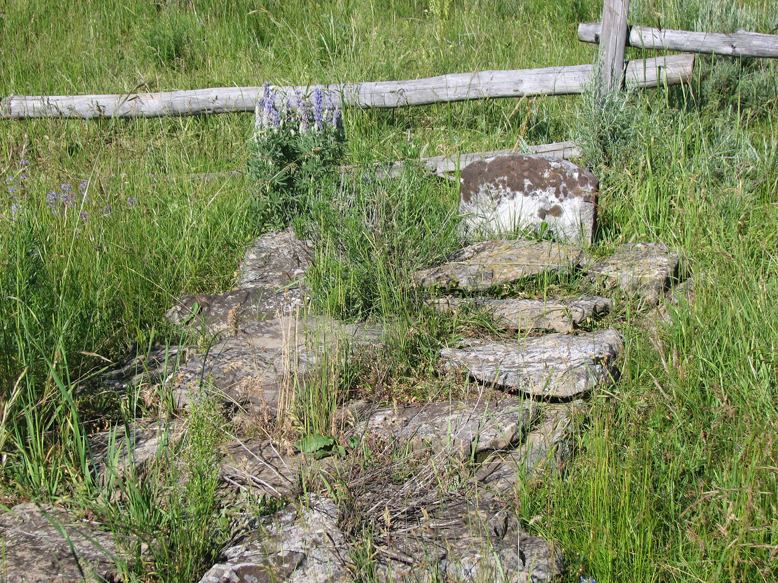
The Idaho chapter has had several outings on the Lander Road in eastern Idaho through the years. Recently, the chapter worked with the National Park Service Trails Office to develop highway and interpretive signs providing more information about John W. Lane’s gravesite and directions to the site.
Idaho chapter member Gary Makey developed a driving guide to access sites along the route in eastern Idaho. Access the driving guide here.
- Lander Road in mountains of eastern Idaho
- Lander Road near Blackfoot Reservoir
- John W. Lane’s Gravesite
©Jerry Eichhorst, 2026. Sources:
- Lander Road, Idaho State Historical Society Reference Series, Number 899, 1988.
- Lander Road, National Register of Historic Places Inventory – Nomination Form, April 24, 1975. PDF accessed 4/21/2026.
- The Lander Road Preconvention Tour August 10-12, Oregon-California Trails Association, 15th Annual Convention, August 13-16, 1997. PDF accessed 4/21/2026.
Upcoming Events
POSTPONED:
Annual Model A Oregon Trail Tour